

Soil Sampling Strategies
go.ncsu.edu/readext?959482
en Español / em Português
El inglés es el idioma de control de esta página. En la medida en que haya algún conflicto entre la traducción al inglés y la traducción, el inglés prevalece.
Al hacer clic en el enlace de traducción se activa un servicio de traducción gratuito para convertir la página al español. Al igual que con cualquier traducción por Internet, la conversión no es sensible al contexto y puede que no traduzca el texto en su significado original. NC State Extension no garantiza la exactitud del texto traducido. Por favor, tenga en cuenta que algunas aplicaciones y/o servicios pueden no funcionar como se espera cuando se traducen.
Português
Inglês é o idioma de controle desta página. Na medida que haja algum conflito entre o texto original em Inglês e a tradução, o Inglês prevalece.
Ao clicar no link de tradução, um serviço gratuito de tradução será ativado para converter a página para o Português. Como em qualquer tradução pela internet, a conversão não é sensivel ao contexto e pode não ocorrer a tradução para o significado orginal. O serviço de Extensão da Carolina do Norte (NC State Extension) não garante a exatidão do texto traduzido. Por favor, observe que algumas funções ou serviços podem não funcionar como esperado após a tradução.
English
English is the controlling language of this page. To the extent there is any conflict between the English text and the translation, English controls.
Clicking on the translation link activates a free translation service to convert the page to Spanish. As with any Internet translation, the conversion is not context-sensitive and may not translate the text to its original meaning. NC State Extension does not guarantee the accuracy of the translated text. Please note that some applications and/or services may not function as expected when translated.
Collapse ▲Soil sampling involves collecting soil samples from smaller areas within a whole field. The field is divided into smaller sections based on the variations in soil properties like soil texture, soil nutrient content, drainage, and landscape variations like slope. Site-specific crop and soil management allows for variable application rates of amendments (lime, fertilizers) with greater precision. Modern technologies like GIS (Geographic Information Systems),GPS (Global Positioning System), FMIS (Farm Management Information Systems), and Variable Rate Technology are employed to assist researchers and producers with site-specific management.
Site-specific soil sampling identifies the spatial distribution of nutrient deficient/sufficient locations and variation in soil properties within the field. This helps enhance lime and fertilizer-use efficiency, reduce nutrient losses, and optimize crop production with targeted use of amendments. This write-up will provide you with the information required to conduct site-specific soil sampling in the best possible way. You will get an idea about various sampling methods, their benefits, disadvantages, and know-how regarding the process of developing a soil sampling plan.
In-situ Soil sampling process:
1. Marking Field boundaries:
Field boundaries can be marked in two ways. The first method involves mapping boundaries using a portable GPS receiver. You can record the GPS positions along the field’s edge via walking or driving. For rectangular fields, recording four GPS positions at the field corners is sufficient. In contrast, continuous GPS points must be logged along the field boundary for an irregularly shaped field. The files can be downloaded in shapefile format to be loaded into GIS or FMIS software to develop base maps. Different GPS receivers are available in the market based on horizontal accuracy.
The second method involves tracing the field outline using GIS software while using aerial photographs as a base map. The USDA Farm Service Agency website has yearly aerial images of the growing season acquired via the NAIP (National Agricultural Imagery Program). You can locate the field of interest, download the aerial images, and load them into GIS/FMIS software. The next step is to create an empty shape file, wherein you can use drawing tools to trace the field boundaries using aerial photographs as a reference.
2. Selecting sampling strategy:
The site-specific soil sampling strategies include cell, point, zone, and various combinations of these called hybrid approaches.
a. Cell sampling:
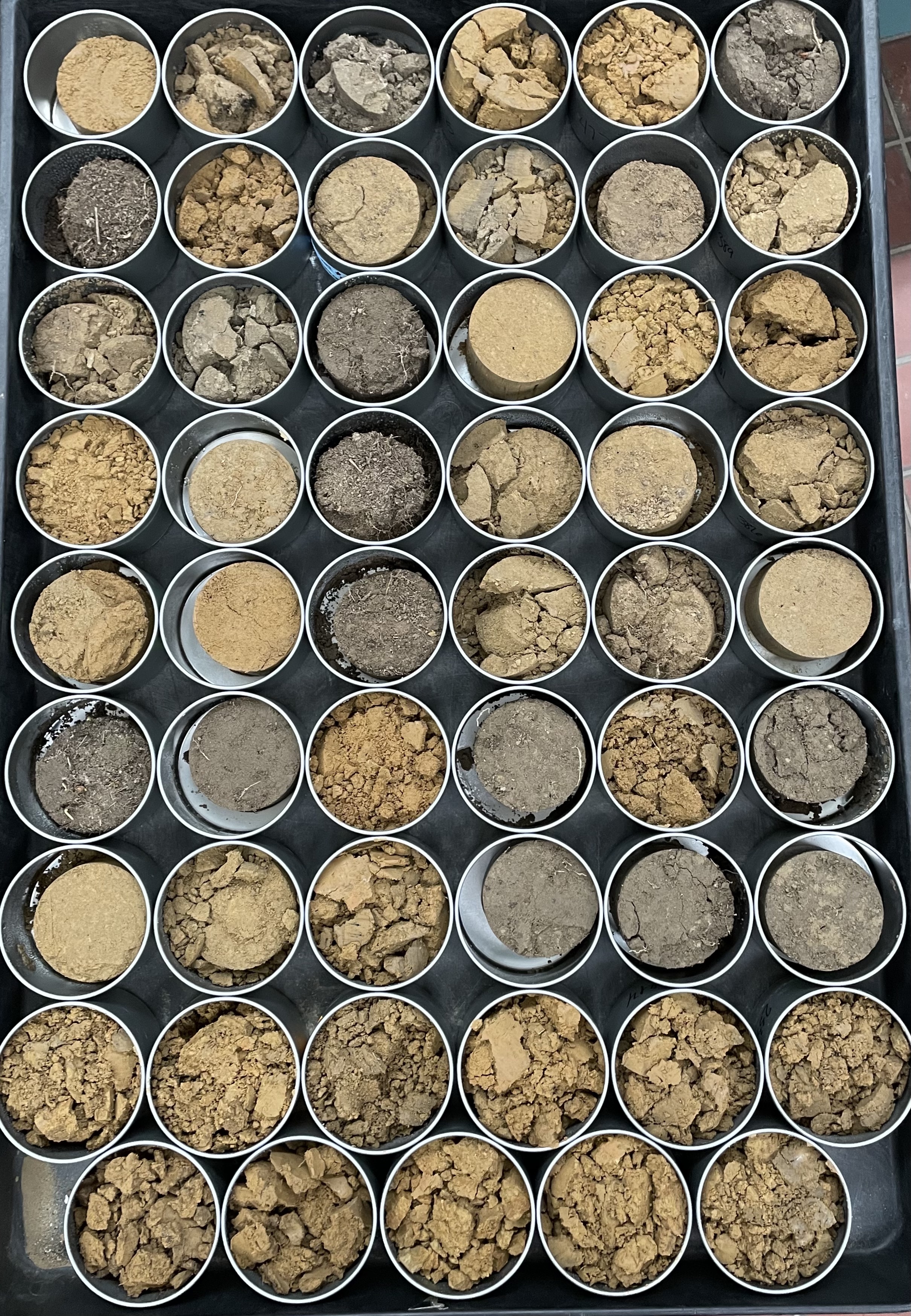
The field is divided into cells (square or rectangle-shaped) by placing a grid over the base map with boundaries. Soil cores (15-20) are dug at random locations (random or staggered pattern) to determine soil characteristics within each cell. Each cell is generally 1-3 acres in North Carolina. Take care to avoid collecting soil cores in a straight line or in clusters.
b. Point sampling:
Point sampling is recommended when little information is known about the field-level variability. 1-3-acre uniform grids are placed, and random spots within grid cells or grid intersection points are identified for soil sampling. After developing the soil sampling plan, the identified spot locations are loaded into a GPS receiver and used to navigate the points. A composite sample with 8-10 cores is collected from a 15-30 feet area around the center of the identified point. After lab analysis of soil samples, interpolation is conducted to predict estimates of soil properties for areas between sampled locations, essentially filling in the gaps. The interpolated maps with information on existing soil properties are then used to determine recommendations required per location. Yield response curves developed based on yield goal, crop requirements and soil nutrient status are used for this. Prescription rate maps with prescribed amendments to be applied at each location are developed in GIS/FMIS software and then uploaded to the variable rate controller. The GPS location of applicator equipment is matched with the location in the prescription rate map to determine the application rate at each location.
The points can be spaced at 100-200 feet in North Carolina. The spacing between selected points can be higher for soils with less variability. For example, at 209 feet, one composite sample per acre is collected. Whereas for more variable soils, less spaced sample collection is recommended. For example, at 104 feet, about four composite samples must be collected per acre of land.
c. Zone sampling:
The field is divided into zones, each of which captures similar soil properties (soil type), production characteristics (previous crop yield), management history, or topographic conditions (elevation). While separating the field into zones, it is essential to use factors shown to impact yield consistently as the determining factors. A composite sample of 15 to 20 cores is collected from a zone with one soil core per acre.
d. Hybrid sampling:
In this sampling approach, the goal is to account for variability with a collection of the least number of samples. They are first separated into production zones using either yield maps or producer knowledge of high and low production areas. Then, the cell sampling technique is employed within zones. The split cells that cross production zones are sampled individually, and if the area crossing the production zone is small, it can be included within the same production zone.
In areas with high variability in soil properties, point sampling is done within the zones, causing closer sample collection at greater density.
3. Generating sampling grid:
Rectangular grids are suited to long (>2,500 feet) and narrow (150-300 feet) fields in eastern North Carolina. More variation occurs across narrow width, requiring sample collection every 100 feet, and more spaced collection at 700 feet is sufficient across the length.
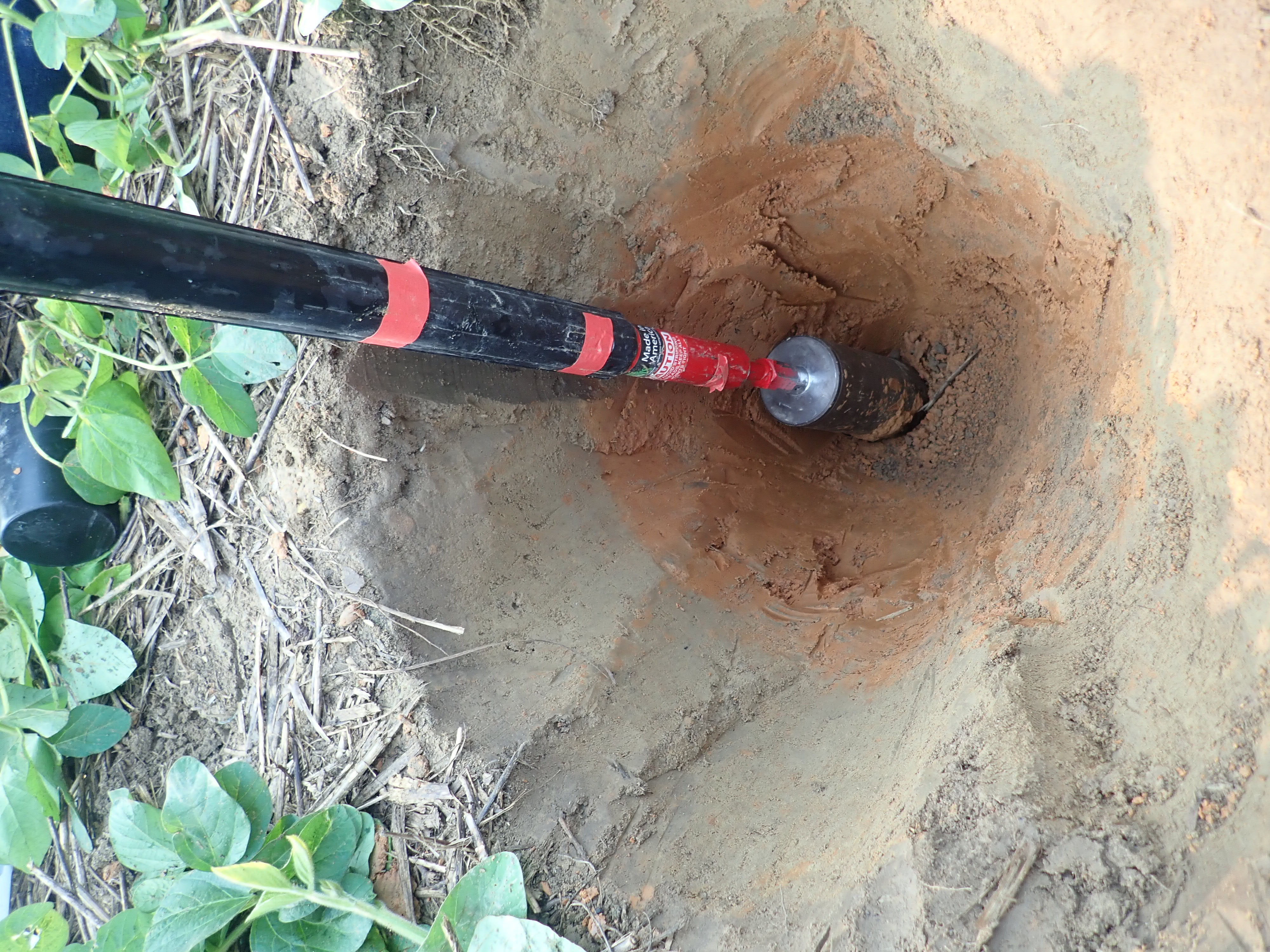
4. Collect soil sampling:
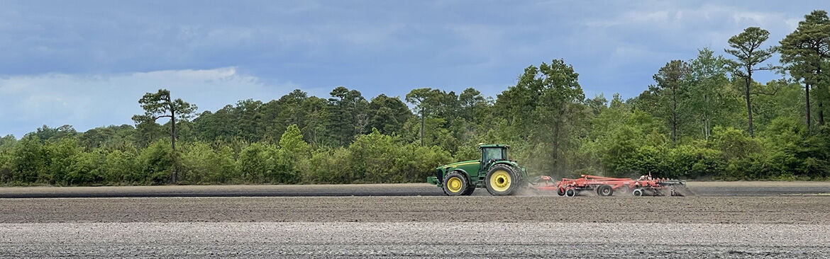
An adequate number of cores and sampling depth accuracy is essential for proper soil sampling. Please refer to the NC State Extension publication Careful Soil sampling-The Key to Reliable Soil Test Information and NCDA publication Soil Sampling Basics for recommended procedures.
Transitioning to site-specific soil management:
When transitioning to a site-specific soil sampling approach, it is essential to begin with point sampling that helps identify the degree and scale of field-level variability. Then, zones and cells can be created to capture the identified variability, reducing labor and analysis costs.
Periodic reevaluation of changes in the soil test levels is essential to account for the changes created by the variable rate application of soil amendments. The soil amendments applied at various rates to different areas over time can interact with environmental factors and change over time. There might be a need to redraw zones or change the application rates, the decision for which needs to be taken by resampling using point sampling.
More information regarding the various terms and technologies used in site-specific soil sampling can be found in the NC State publication Soil Sampling Strategies for Site-Specific Field Management.